
Meteorological and climatological maps

TowerCheck Paper 
AI models for damage detection on high-voltage power grids using satellite radar imagery ...
ESA Fringe 2026
ESA Fringe 2026 workshop, Krakow, Poland, 15-19 June 2026 ...
Quantum Master @UNIBA
Quantum innovation meets Earth Observation.
GAP - 20 Years Together
A journey of vision, people, and shared growth.
RETURN 2026 - Infrastructure Safety
MT-InSAR monitoring of bridges and tunnels within the ARTEMON-BT project, Intesa Sanpaolo Skyscraper, Turin (Italy), 15-16 January 2026.
VH-RODA 2025
6th Very High-resolution Radar & Optical Data Assessment Workshop, ESA-ESRIN, Frascati (Rome, Italy), 17-21 november 2025 ...
DOTS4IT Final Event
Results dissemination - October 2025
GAP-UNIBA Meeting
Project update - October 2025
DOTS4IT Task 2
Task 2 completed - September 2025
SIET Conference
DOTS4IT presentation - September 2025
Quasimodo Workshop
GAP presents DOTS4IT - September 2025
DOTS4IT Task 1
Task 1 completed - June 2025
DOTS4IT seminar
GAP at Politecnico di Bari - May 2025
DOTS4IT Meeting
GAP & UNIBA meeting - March 2025
MasterQuantum
The Master in Quantum Science & Technology is now starting ...
DOTS4IT Kick-Off
Project launch - October 2024
Follow us on



Products  Meteorological services Meteo-climatological Maps
The interpolation of weather data can be performed with different techniques; the definition of the appropriate technique for the correct representation of each atmospheric variable (in terms of its variability and its nature) must be made through careful analysis of the error.
GAP has dedicated services concerning:
• The implementation of WMO-based procedures for the quality control of temperature, barometric pressure, humidity, wind speed, wind direction, and precipitation measurements.
• The investigation of different spatial and temporal interpolation schemes (RBF, Kriging, Barnes, etc.), involving also the use of Numerical Weather Models, for optimal interpolation of measurements taken by weather station networks.
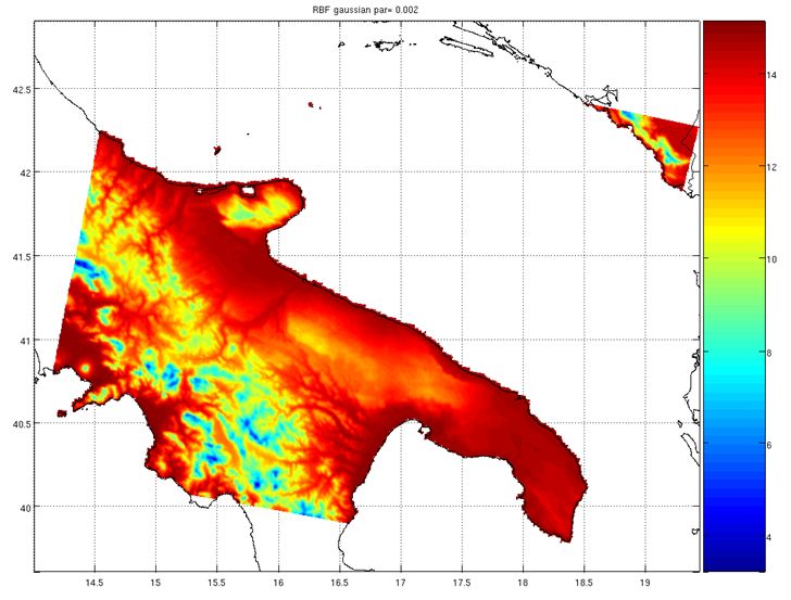
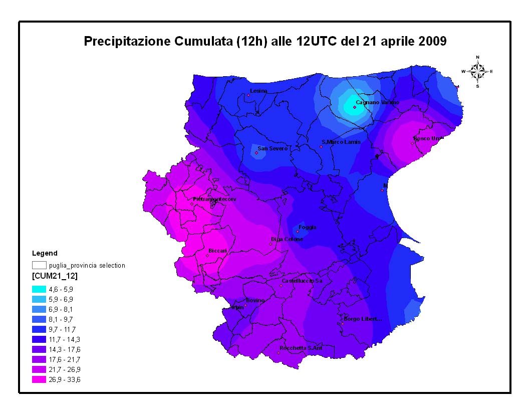

Climatological data interpolation (min temp of the first decade of january, 1951-2001) on the left, meteorological real time data interpolation (3hrs rain cumulated) on the right