
Fire Risk Maps

weather services
and fire risk maps
Forest fires can be regarded as one of the main causes of environmental degradation, contributing on a large scale to global changes (climate, etc.).
Risk can be thought of as the combination of two elements: the fuel, with its susceptibility to fire (fire hazard), and all the external factors (both natural and human-induced) that influence the ignition of a fire. Fire risk analysis enables the definition of an index expressed as a mathematical relationship linking these various factors. Static risk is strongly influenced by factors that are constant or vary very slowly over time, such as morphological factors (exposure, slope), static environmental factors (land use and vegetation cover) and human factors (the extent of urban areas, the road network, the location of activity centres, and the frequency of fires over at least the last five years). In the short term, however, fire risk (particularly fire ignition and spread) is closely linked to factors such as vegetation (types and density, maintenance and management practices), orographic factors (altitude, aspect and slope inclination, isolation), and meteorological factors (air temperature, air humidity, wind speed and direction, cumulative precipitation over the last ten days). The latter are particularly linked to the ignition of fires and the likelihood of their spread. Advance knowledge of weather conditions can be extremely useful for forecasting fire risk.
GAP can produce both static fire risk maps and dynamic fire hazard maps using meteorological forecast data, and focuses on the dynamic and atmospheric aspects of fire risk. The resulting maps can be a very useful tool both for agricultural and forestry management and for civil protection planning to prevent disasters.
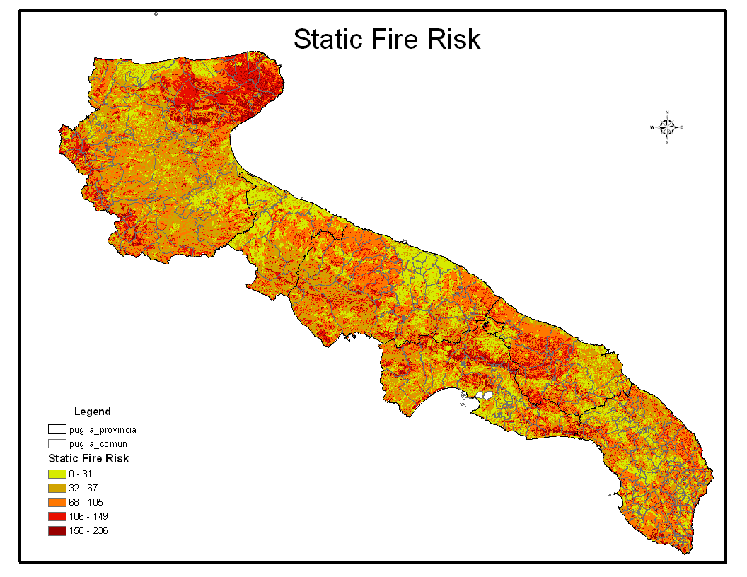

Static fire risk maps
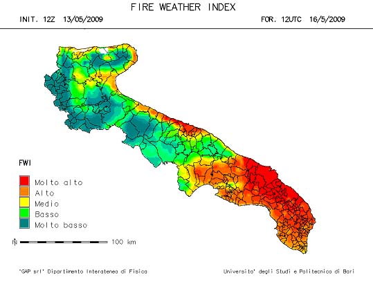
Fire Weather
Index
Products and meteorological services Fire risk maps